🛞 TyreTrack: Making the Invisible Visible
done
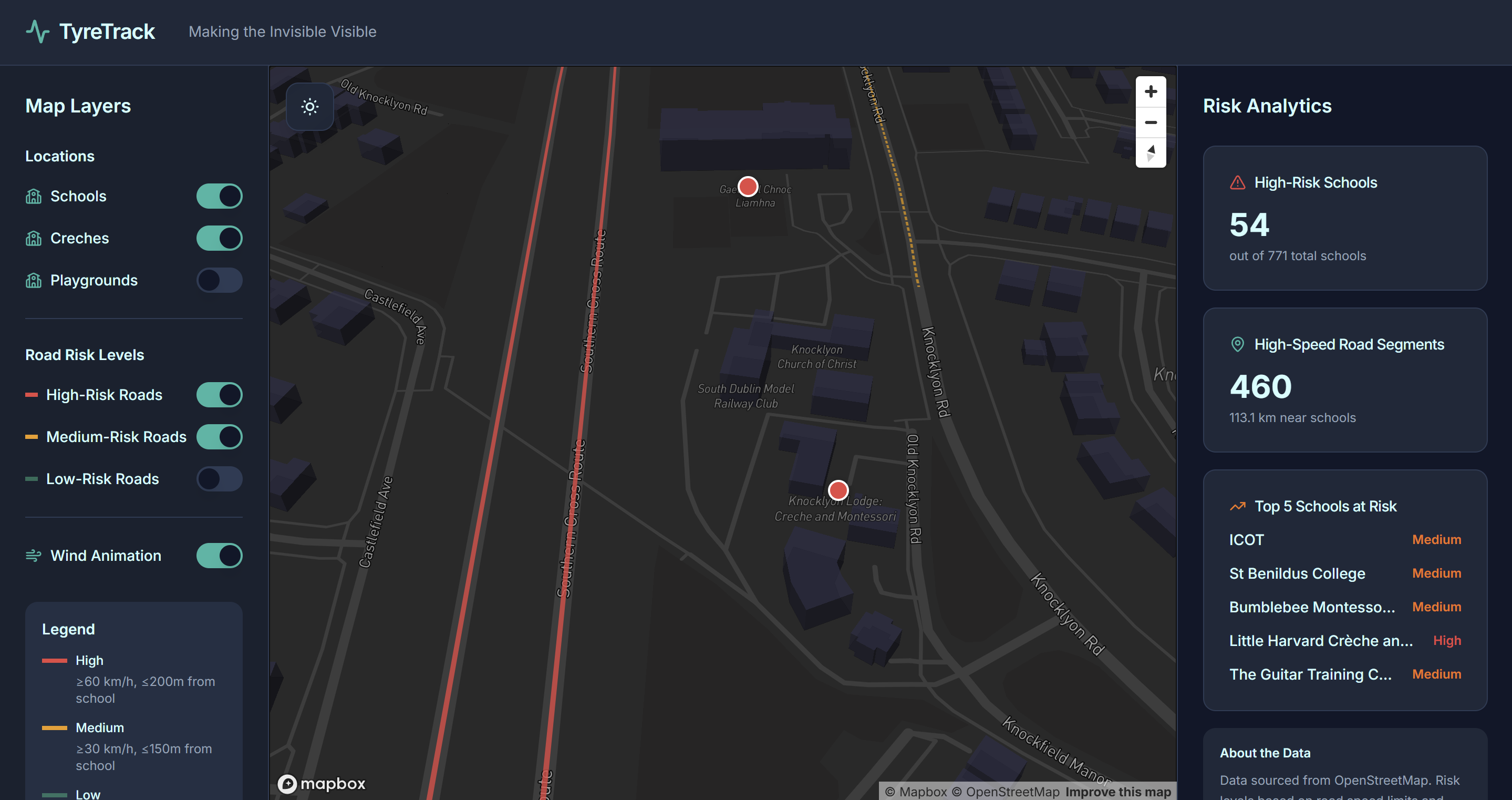
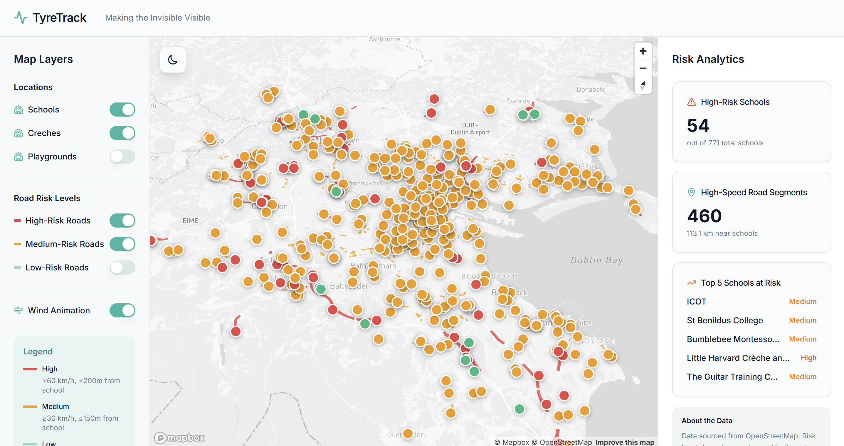
TyreTrack is an awareness and data-visualization platform that maps tyre-wear microplastic exposure in cities.
It overlays roads, traffic intensity, and sensitive locations like schools and playgrounds to make an invisible problem visible.
During a 4-hour hackathon, our team (Julian, Toby, Roshan, and myself) built a functional demo that:
- Shows traffic density as a heatmap
- Highlights exposure zones (buffers around schools intersecting high-traffic roads)
- Provides simple exposure scoring (High/Medium/Low)
- Offers interactive tooltips/popups with risk context
But why?
Tyre wear is a major source of microplastics-studies estimate it accounts for up to 30% of primary microplastics released into the environment. These particles travel through air and water and are linked to respiratory illness, heart disease, and developmental harm in children near busy roads.
TyreTrack helps communities, schools, NGOs, and policymakers identify hotspots, plan safer routes, and prioritize monitoring and interventions near vulnerable areas.
🥇 This won us first place at the Zeeus hackathon!
Project Images